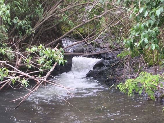
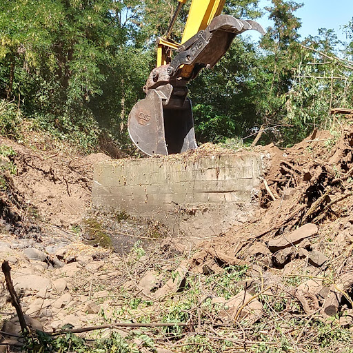
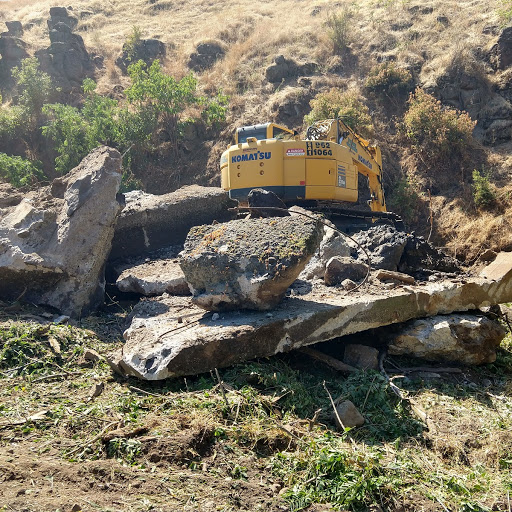
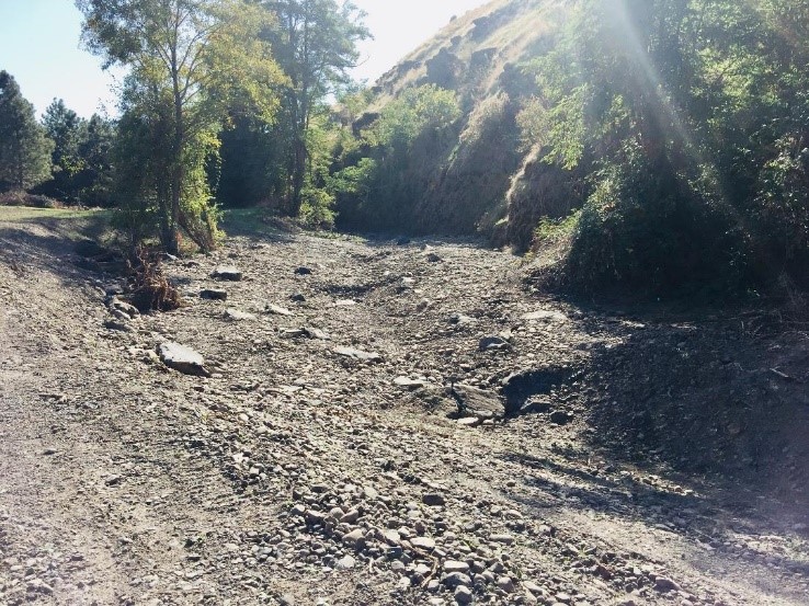
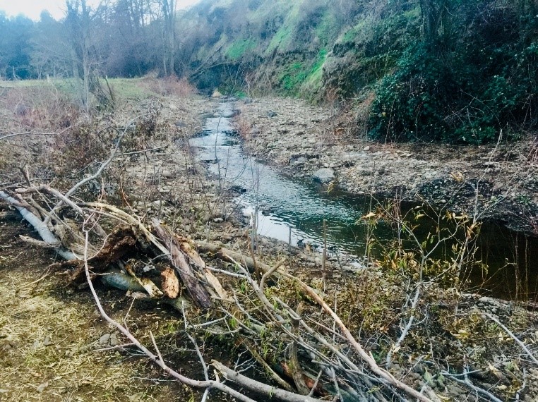
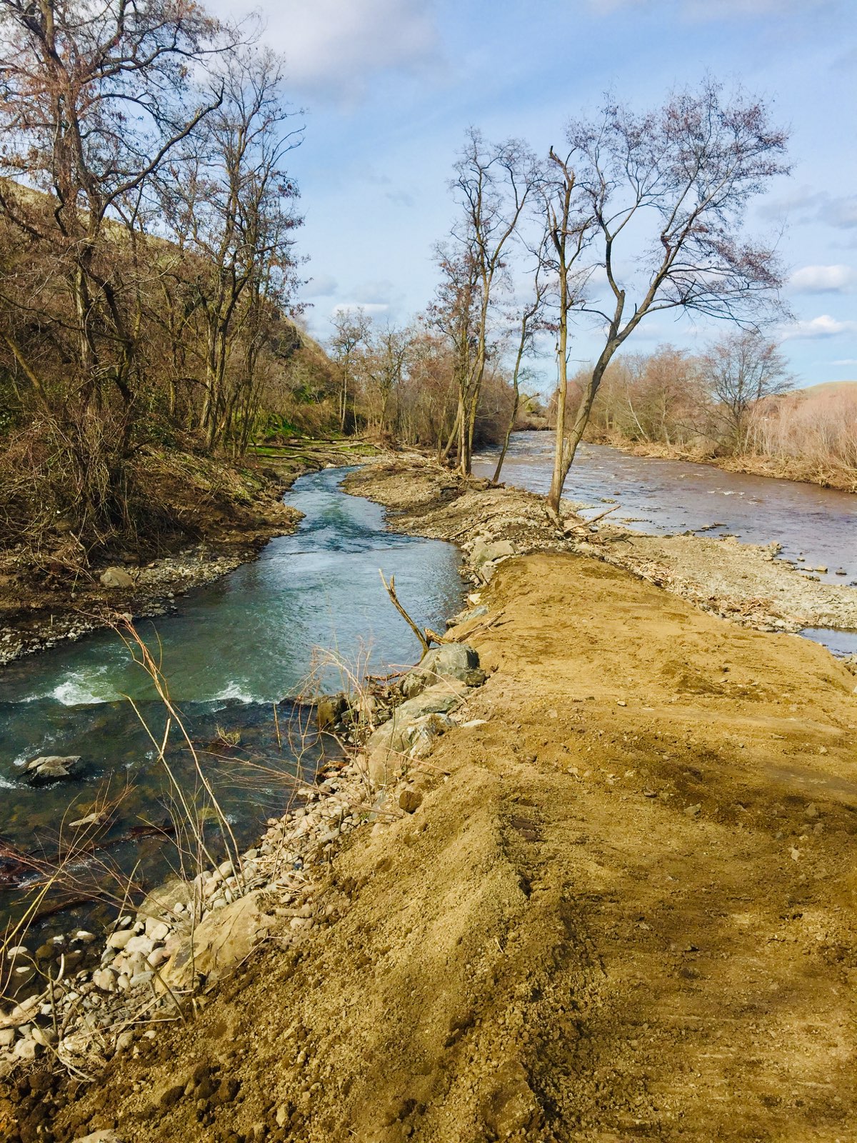
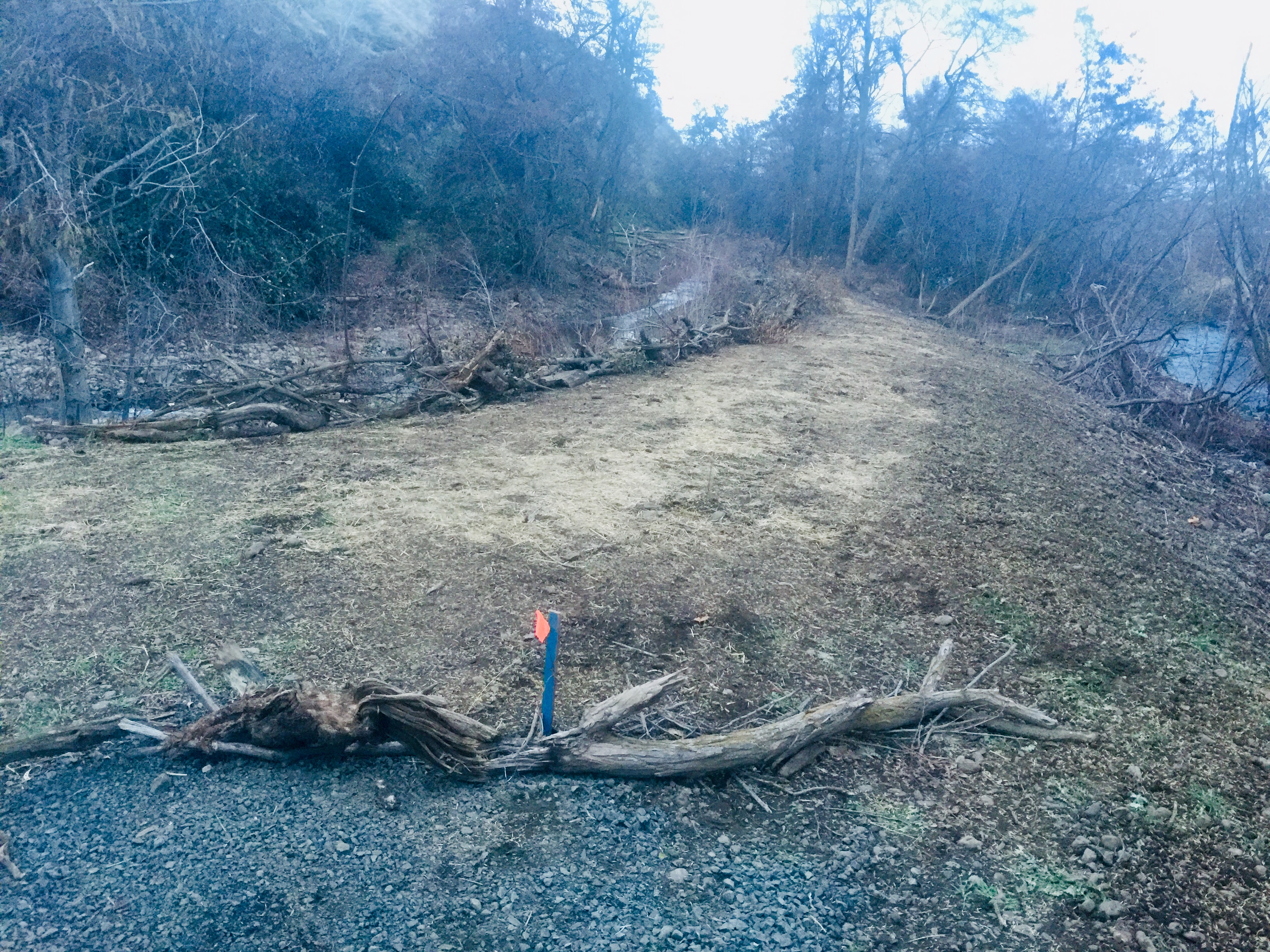
Couse Creek is described in the Walla Walla Sub-Basin Plan as a Priority Protection Area based on Ecosystem Diagnosis and Treatment analysis. The Plan identifies the elimination of man-made fish passage barriers as a priority action for improving salmonid population status which are currently at reduced levels compared to historical levels. The WWBWC actively participated in the improvement of passage conditions at the three locations in the Couse Watershed. In 2010, a new bridge was installed near RM 3. In 2019, the concrete impediment at the confluence was removed (Figure 1-4). Following construction, the project area was very barren and in need of vegetative re-establishment (Figure 5-7). In 2022, the final anthropogenic barrier was eliminated with the removal of an archaic irrigation dam at RM 3.5. Upon having rectified all known fish passage barriers in the Couse Watershed, the WWBWC will now focus on improving habitat suitability for salmonids in the 11 miles of habitats located areas upstream of the former barrier locations by utilizing a variety of habitat improvement strategies aimed at improving watershed function with the intent of contributing towards recovery of endangered salmon species by fully seeding habitats.
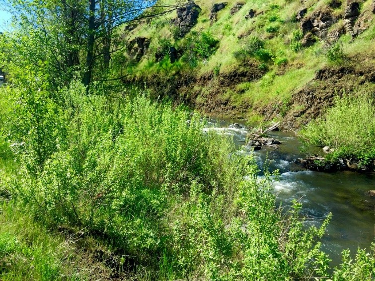
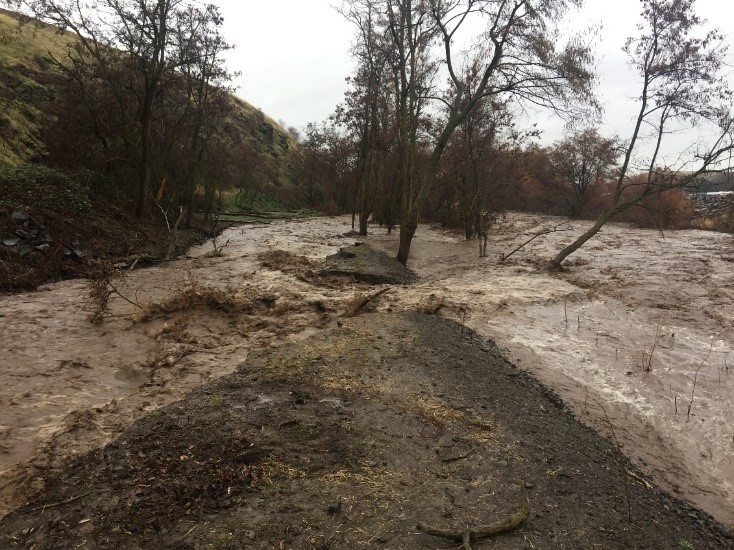
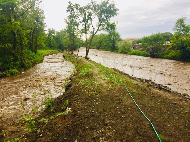
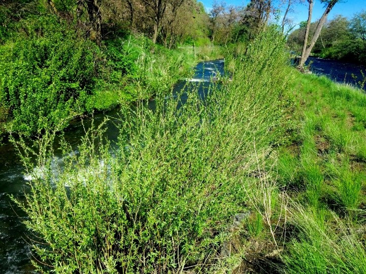
The Walla Walla Basin experienced the greatest flood on record during February of 2020, just four months after the Couse Confluence Passage project was completed. The site experienced some detrimental effects from the flood (Figure 8-9). Therefore, maintenance was justified and completed to repair significant damage to the streambank (Figure 10). Water quality conditions in Couse Creek can be superior to the adjacent Walla Walla River and offer refuge during catastrophic events Figure 11). Based upon lessons learned, it was decided that decreasing the abrupt angle of the meander and repositioning large boulders to the outside curve would be the adaptive management strategy to prevent further evulsion. An additional high water event occurred during May of 2020 and tested the project's resilience, which performed admirably as the creek stayed within banks (Figure 12-13). Much emphasis was placed on establishing vegetation on the outside portion of the bank for long-term functionality in terms of habitat creation as well as project protection and functionality (Figure 14-20). Multiple redds have been documented in the project area every Spring season following project completion (Figure 21). A tour of the project site was successfully conducted in April of 2023 which received positive feedback with appreciation for the results of the project efforts.
Project results have been very successful in the long term following effective adaptive management techniques in response to changing environmental conditions. Fish passage challenges were rectified, spawning gravels replaced oversized cobbles, and complexity features in and out of the stream have substantially improved suitability for salmonids. Dramatic changes to the vegetative components riparian area was achieved by Fall and Spring supplemental plantings until the desired results were achieved. Noxious weed growth was suppressed by physical removal of undesirable species. Photo point comparisons provided at the end of this report provide visual evidence of significant improvements achieved at the site. Photo point locations three and four were discontinued after the pre-implementation set of pictures were taken by an employee that has since departed from the WWBWC. The reason for discontinuing the two locations is that they were located beyond boundaries of project and therefore would not show changes related to restoration efforts. Therefore, additional photos were taken at all of the remaining photo point locations and provided in this report. This project site was toured by interested public parties during April of 2023 with positive feedback. Monitoring project status on a frequent basis ensures project performance over time and informs proactive and reactive adaptive management actions to optimize project results.

PICTURES
Project site condisions mid repair work
Post construction and planting
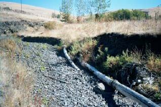
Previously, from the years 1996-1998, the WWBWC completed a project on Couse Creek known as the Shumway Project. The goal of the Shumway Project on Couse Creek is to reconnect perennial flows, reduce shoreline erosion, enhance riparian cover for fish and wildlife species, and improve stream form and function. The project is located along Couse Creek (a tributary of the Walla Walla River) on private property some four miles south of the town of Milton-Freewater.
 |
Couse Creek Shumway Project |
| Project Years: 1996-1998 | |