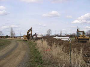
| The Walla Walla River Irrigation District (WWRID) converted 3.6 miles of earthen irrigation canal to 3.32 miles of buried pipeline to serve 258 acres of Senior (summer) water rights. The pipeline operates as an on-demand system diverting water equaling the use along the pipe, greatly reducing the acre-foot total removed from the river. WWRID was able to consolidate turnouts and straighten the ditch as the pipeline was installed in order to increase efficiency. New fish screens, measurement devices and headgates were installed at the diversion point on the Walla Walla River improving fish passage and monitoring capability. WWRID developed a landowner and water rights database of patrons served by the pipeline and signed new easements with the landowners. A new magnetic flow meter was installed at the Point of Diversion to measure and monitor the amount of water used. Additional meters were placed on user turnouts over 2" in diameter to allow the district to better manage water rights and collect individual water use information. |

