 |
General
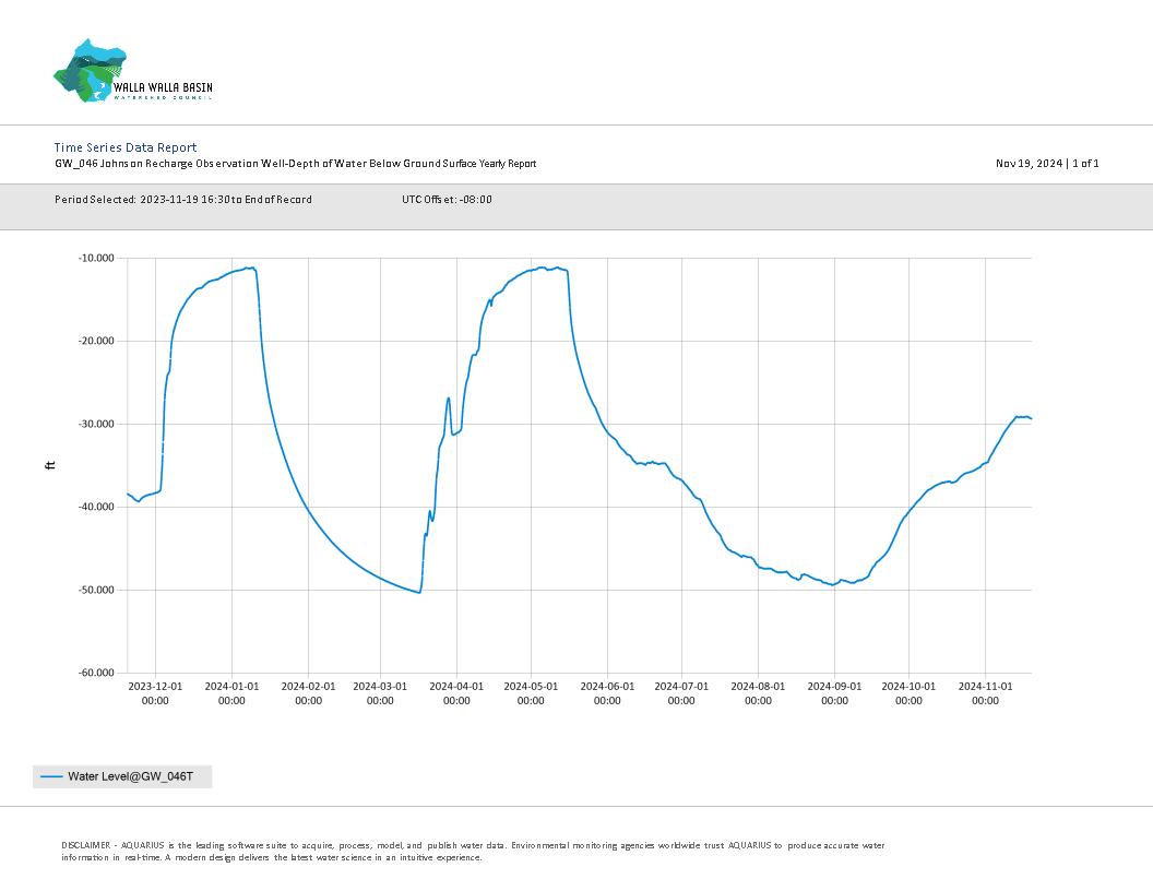
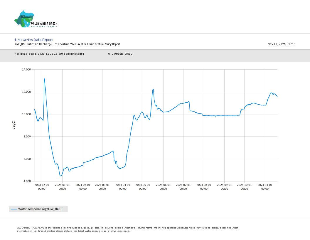
Yearly Well Data
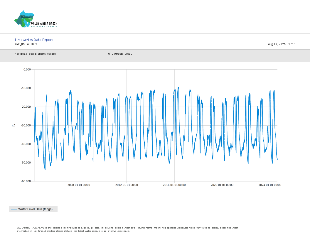
All Well Data
Johnson Aquifer Recharge Information
Johnson Aquifer Recharge Data
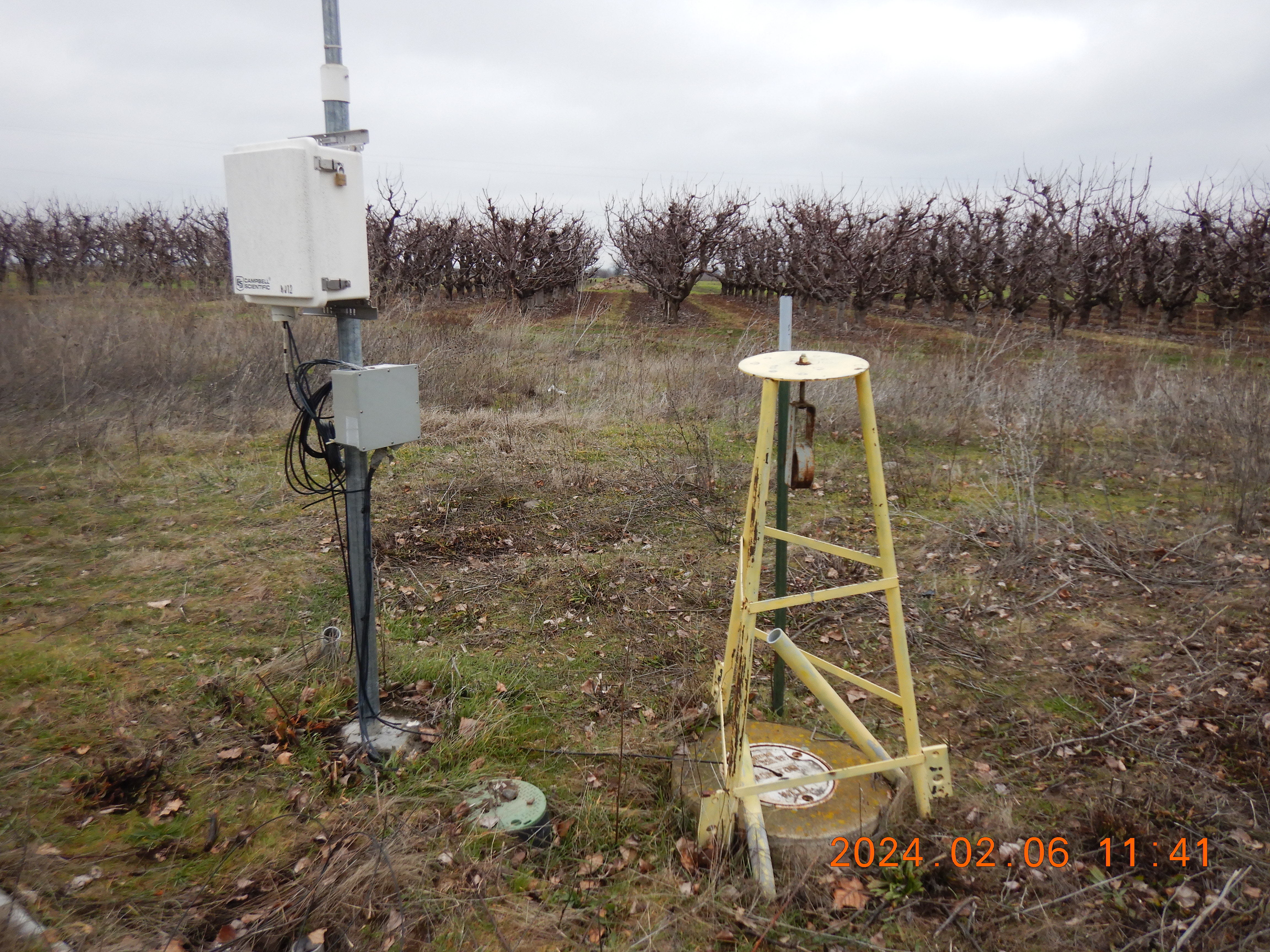 |
Description: The well is located down-gradient of the Johnson Aquifer Recharge Site. |
All Well Data Hydrograph (feet below ground surface - ft bgs)
Download All Data
Download All Data (.csv format)
Download Daily Average Data (.csv format)
Metadata for Data (.txt format)
*Data is updated every 3 months
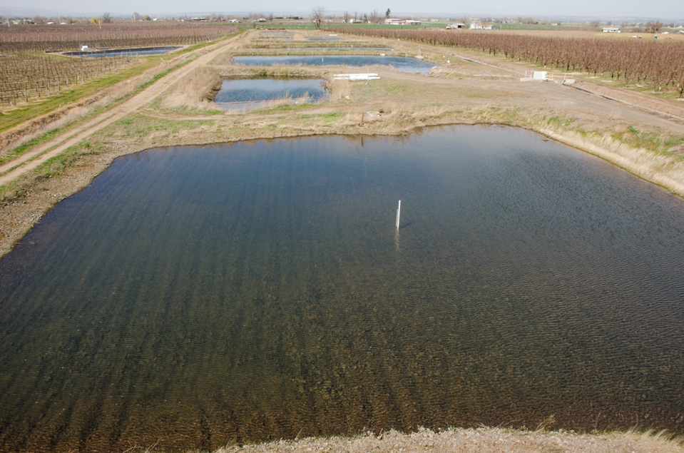 |
Johnson Aquifer Recharge Site (Formerly known as the HBDIC Aquifer Recharge Site) |
|
Construction Years: 2004-06, 2009 & 2010-11 Recharge Seasons: 2004 - Present |
|
| Project Description | |
|
The Johnson AR site, formerly known as the Hudson Bay site, has been operating since 2004. The Johnson site has grown in three phases since operations began. The initial 2 phases are described extensively in the final report for the first limited license. The site currently has the capacity for approximately 16 to 17 cubic feet per second (cfs) of infiltration into approximately 3 acres of infiltration basins (spreading basins) and 3 infiltration galleries. Per the Oregon Water Resources Departments (OWRD) Limited License, water allocated to this project is sourced from the Walla Walla River using an irrigation diversion and canal delivery system that originates in the town of Milton-Freewater, OR. The limited license requires a minimum flow amount to remain in the mainstem Walla Walla River, water quality testing, and monitoring of local surface water and groundwater hydrology. 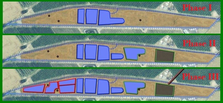
The Johnson site was originally constructed with three spreading basins. The three original basins were constructed in the winter/spring of 2004. These basins were increased in size during 2005 to almost triple their area. Phase II included adding an up-gradient spreading basin in 2006 and the addition of four infiltration galleries in the winter of 2009. Water for the new up-gradient basin was fed through the original diversion with water being “pushed” into it from the first basin. Phase III included the addition of four additional basins on the lower end of the property, a new out-flow measurement weir, a new pipeline that feeds water to each individual basin, a telemetry system to remote monitor the site and an alternate method to deliver water to the up-gradient basin. During Phase II, four infiltration galleries (IG) were installed at the Johnson site for testing purposes. IG #1 was constructed of corrugated 4” perforated pipe, IG #2 was constructed of 4” drain field pipe, IG #3 was 4” drain field pipe inside Stormtech stormwater chambers and IG #4 was drain field pipe inside Atlantis stormwater devices. During the first season of testing IG #1 clogged up and has not been utilized since. IG #2, IG #3 and IG #4 have all continued to function and have been operated during each recharge season. The four different infiltration gallery designs were installed to create a cost-benefit analysis of the different design types and to determine each design’s longevity. |
|
| Documents | Document Name | Download Documents |
| Project Designs | Click here to download | |
| Project Reports | Click here to view reports | |
| Johnson Site Hydrogeologic Assessment Report | Click here to download | |
| 2005-06 Water Quality Plan | Click here to download | |
| 2008-09 Water Quality Plan | Click here to download | |
| 2013 Water Quality Monitoring Plan | Click here to download | |
| Limited License LL758 Application | Click here to download | |
| Limited License LL758 | Click here to download | |
| Limited License LL1189 Application | Click here to download | |
| Limited License LL189 | Click here to download | |
| Limited License LL1433 Application | Click here to download | |
| Limited License 1433 | Click here to download | |
| Ari Schilfgaarde Thesis | Click here to download | |
| Aristides Petrides Jimenez PhD Thesis | Click here to download |
| Contacts & Partners | Name | Role | Organization |
| Steven Patten | Project Lead | Walla Walla Basin Watershed Council | |
| Jon Brough | Site Manager | Hudson Bay District Improvement Company | |
| Bernard Hewes | Project Engineer | Hewes Engineering |
| Grants & Funding | Organization | Contract # | Funding Amount |
| Oregon Watershed Enhancement Board (OWEB) | |||
| Bonneville Power Administration (BPA) | |||
| Walla Walla Watershed Alliance | |||
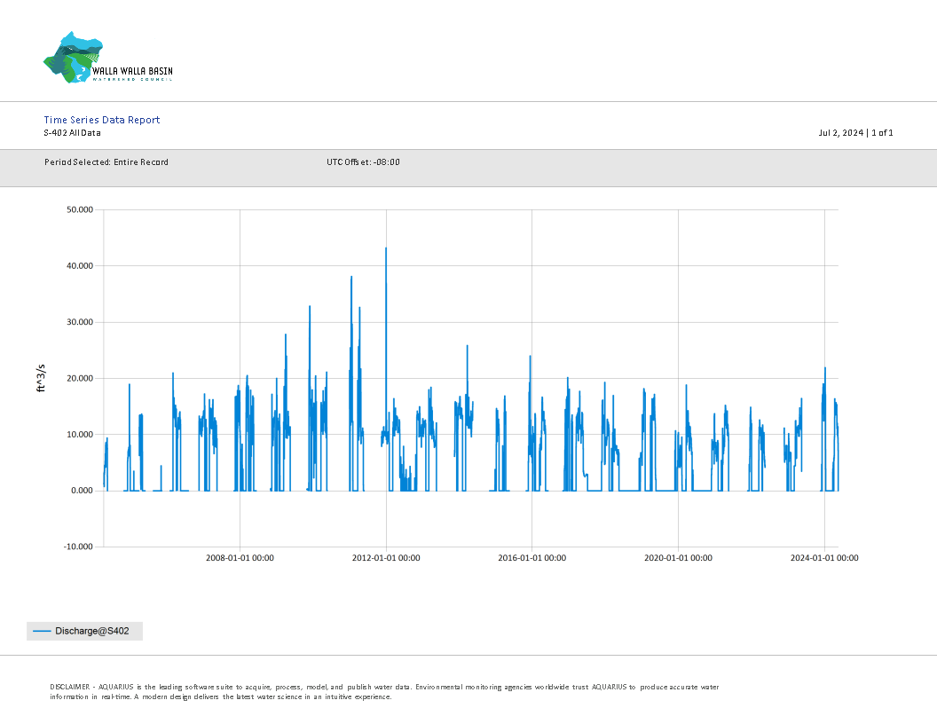
S-402 Inflow All Data (cubic feet per second - cfs)
Download S-402 All Data (.csv format)
Metadata for Data (.txt format)
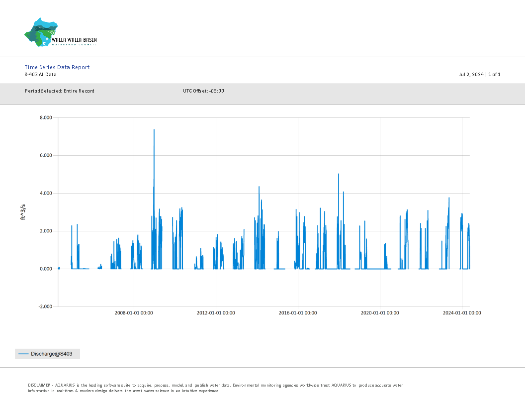
S-403 Outflow All Data (cubic feet per second - cfs)
